
TREELINE INSIDER
Receive early access to course updates, educational content, podcast releases, and special promotions. Stay Connected....

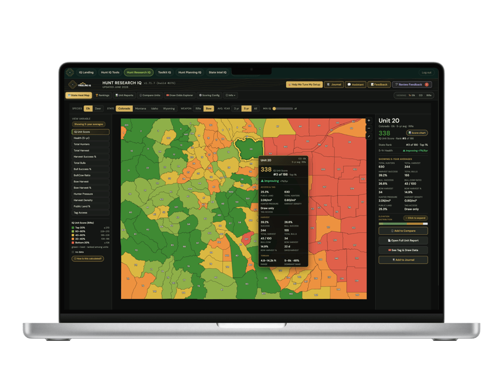
• Heat Mapping • Unit Research • Draw Odds Analysis • Unit Reports • Unit Briefs • Pressure Analysis • Compare Unit Tool • Google Earth Toolkits • State Intel Reports • Onboard Hunt Planning System • NEW: Gear Vault & Pack Lists • Gear Library & Partner Discounts and a lot more!
5.0 ⭐️ - From over 100 Treeline members
As heard on: The Gritty Podcast ‣ Rich Outdoors ‣ Eastmans' Elevated & over 150 podcast episodes
As Western hunters, we continually seek to enhance our skills and develop tactics that increase our success in the backcountry. Treeline Academy is dedicated to expanding the pursuits of the western backcountry hunter.
Our "new" research platforms, advanced courses, hunt planning systems, and Google Earth Pro Toolkits are complete end-to-end Western hunt solutions.
These solutions will dramatically improve your odds of success!
It's exactly what we do, and we 100% guarantee it!

Ultimate Western Bundle
Bundle • Add IQ Suite Discount Option
Includes the E-Scouting Elk Course, Unlocking Spring Bear Course, all Treeline webinars, and DIY Backcountry Meals Course! Everything you need to take your Western pursuits to the next level.
$159 - Lifetime Access
Add Hunt IQ Suite • Only $79/yr • Save 10%
NOTE: Select add to your order to get the discount!

Hunt IQ Suite
Five Tool Suite • Now With Gear Vault IQ
Decades of harvest data and draw odds across 10 Western states. Score, rank and compare every unit, plan your hunt, then build your pack list in the new Gear Vault IQ.
One System • One Workflow • Zero Guesswork
$89/yr - 7-Day Free Trial
* Includes All Five IQ Tools
E-Scouting Elk Course
Bundle • Hunt IQ Suite Discount Option
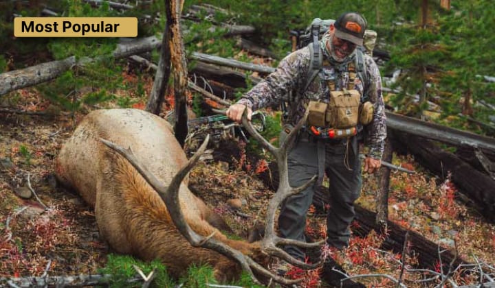
This 30+hour intensive needle-moving elk course offers the most definitive elk-finding & hunt planning solution ever assembled!
"You Can't Kill Elk.... If You Can't Find Elk"
$129 - Lifetime Access
Add Hunt IQ Suite • Only $79/yr • Save 10%
NOTE: Select add to your order to get the discount!

Online Course
Western Bear Course
This comprehensive spring bear course delivers the critical skills, knowledge, strategies, and tactics needed to locate and harvest bears consistently.
$59 Lifetime Access

Membership
Google Earth Toolkits
If you hunt big game in the West and are not leveraging the power of these Toolkits you're putting yourself at a big disadvantage.
$39 yr
*Included w/ IQ Suite
Online Course
Llama Rental Packing Course
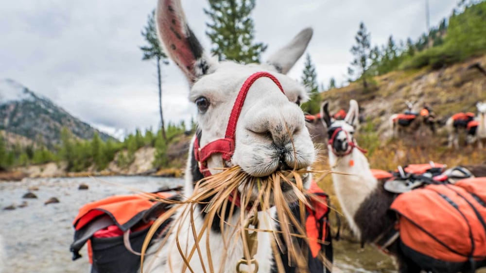
The llama packing course is an end-to-end resource that guides you through renting, handling, and packing with llamas.
$85 Lifetime Access
Online Course
Free Webinar
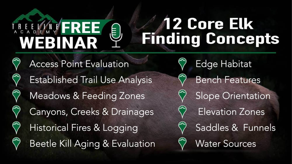
In this "Free" webinar, we introduce the twelve core elk finding concepts. These principles are the foundation to finding more elk and the cornerstone of the E-Scouting Elk Course.
FREE


All courses come with 100% money back guarantee.
You have nothing to lose and everything to gain!
THE HUNT INTELLIGENCE SUITE
One complete system · One workflow · Zero guesswork.
State Heat Map
A color-coded heat map that cycles through more than a dozen critical harvest-data variables, percentile-ranked by 3-, 5-, or all-year averages.
Ranking Panel
A decade of official harvest data, normalized to state-level deciles and blended through your own importance controls into a single composite score.
Unit Reports
A unit-specific breakdown: every variable, averages, rankings, health trends, resident & non-resident draw odds, elevation zones, and more.
Hunt Research IQ
Combines decades of published harvest data and draw statistics across 10 Western states. It scores and ranks every unit and evaluates each unit’s health trends.
Hunt Planning IQ
Where it all comes together: a step-by-step checklist of nearly 100 planning items, plus an e-scouting journal that turns your unit(s) into a real hunt plan with backups baked in.
Gear Vault IQ
Enter all your gear once, with real weights, then build a pack list for every hunt. Check it off from your phone, and shop the Gear Library with some of the best discounts in the industry.
Compare Panel
Stack up to 10 units side by side and let the numbers guide your pick. Printable comparison reports streamline unit selection.
State Intel IQ
Decodes the West’s regulations — deadlines, point systems, fees, licensing, and annual changes — in one quick-reference breakdown. No more digging through state PDFs.
Terrain IQ NEW
The e-scouting map, in your browser and on your phone: every Treeline layer for 11 Western states, unit research linked in, thermals, routes, viewshed, old topo trails and an AI scout. No Google Earth needed.
 New · Now in Beta
Western e-scouting just moved to the next level.
It’s about time.
Meet Terrain IQ, the most powerful Western e-scouting tool there is. Every Treeline data layer for all 11 Western states, built in. Unit research, harvest data and draw odds, wired into the map. Thermals, route planning, viewshed, old topo trails and an AI scout. Nothing to install and no apps to update: open it in any browser on your computer, or add it to your phone like an app.
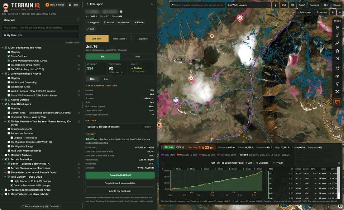
One screen: every Treeline layer, the unit’s score and harvest numbers, a route with real hike times, timber cuts, dark timber and bedding benches. Imagery © Esri.
The top eight, out of 28:
Unit research, linked right in
Click any unit for its score, harvest numbers and tags, then open the full Unit Brief and draw records from Hunt Research IQ without leaving the map.
Scout IQ, your AI scout
Ask in plain words, like “take me to unit 417, show public land and elk portions.” It answers from Treeline’s courses and drives the map for you.
The most advanced route planning available
Miles, climb, steepness and real hike time on every route, then fly it in 3D with the drone flyover before you walk it.
Thermals & sun
See which way the air moves on every slope by time of day, plus sunrise, shade and glare, before you pick your approach.
Bedding benches
Flat, north-facing shelves on steep slopes, partway up the drainage: the security cover elk bed in, ranked good, better and best. Montana, Wyoming, Idaho, Colorado and Utah.
Hunting pressure: remote core & pressure zones
See the ground ½, 1 and 2 miles from every road open to a vehicle, or dial a remote-core distance up to 5 miles and show only the country that far in.
Old Topo: the trails today’s maps forgot New
Every USGS topo map printed since the 1880s, right over your map. Old pack trails that dropped off today’s trail data are still on them. Pick an era and fade it to compare.
In your pocket, like an app New
Add it to your phone’s home screen and it runs like an app: your location on the map, track your hike, every layer and tool, all synced with your computer.
Access roads & easements
MAPLand legal access easements across private land, Forest Service roads with their travel designations, BLM roads and trails by vehicle class, and every road USGS maps.
MVUM overlays
The official Forest Service Motor Vehicle Use Map sheets laid right on the terrain, with a link to each sheet’s official PDF, the legal map.
Timber cuts & prescribed burns
Every Forest Service cut and prescribed burn since 2001, by type: clearcuts, thinning, underburns and more. Dial in a minimum acreage and pick the years that make the best feed.
Fire history, 40 years deep
Every large fire back to the mid-1980s, plus current fires with satellite heat detections. Pick the years you want and find the burns at their peak for feed.
Viewshed
Click a glassing spot and see exactly which ground you can see from it, out to 3 miles or more, before you hike in to sit there.
Slope steepness & orientation
Steepness in six bands and north- and south-facing slopes painted separately, live from USGS elevation data. Find the dark north faces and the benches between the cliffs.
Tree canopy & dark timber
Open ground, light timber and dark timber painted by how thick the canopy is. Find the dark timber elk bed in and the openings next to it where they feed.
Drone flyovers
Fly any route in 3D before you walk it, at the speed, tilt and distance you choose, to see the lay of the land before you hike it.
Custom contours
Contour lines at 10, 20, 40 or 80 feet with elevations labeled, over any basemap, plus a distance grid from ½ to 3 miles.
Grazing allotments
The grazing allotments on public land, so you know where cattle may be running before you plan your hunt around a basin.
Recreation features
Trailheads, campgrounds, cabins and more, labeled by type. Click one for the details and a link to its official page.
Wetlands New
Wet meadows, willow bottoms, marsh and ponds from the USGS land cover map and the U.S. Fish & Wildlife wetlands inventory. Click one to see its type and how often it holds water.
Live conditions
Current snow depth, the weekly Drought Monitor, SNOTEL snowpack and soil moisture, and active fires with satellite heat detections.
Spring bear snow history
For Montana, Idaho and Wyoming: NOAA snow maps for the same spring dates every year back to 2020, plus the state bear harvest reports.
Satellite, aerial & topo basemaps
High-res satellite imagery, USDA aerial photos by year back to 2010, USGS topo, and satellite views from the last few days for snow, green-up and fresh burns.
Lidar
Bare-earth lidar hillshade strips the trees away, so the benches, saddles, old roads and trails hidden under timber stand out. Plus 1-meter USGS lidar where it’s been flown.
Split screen
Compare topo and aerial side by side, or swipe between two years of imagery to see what changed.
Shared hunts with your partners
Share a folder with your hunting partners. Everyone sees the same pins, routes and journal, and the partners you let edit can add to it.
Bring your onX & Gaia pins
Importing from onX keeps your same waypoints, icons and colors. Gaia and CalTopo come in too, all synced to your account.
Full e-scouting journal
A dated log of your scouting notes, pinned to spots on the map or kept general, so every season builds on the last.
State, unit and tag research, e-scouting, hunt planning and gear management, all in one advanced Western hunting system.
Try all five tools free for 7 days.
$0 today, then $89/year. Cancel anytime.
Start my free 7-day trial →Already a Treeline Hunt IQ member? Terrain IQ is already on your dashboard. Open Terrain IQ →

WATCH IT IN ACTION · THRIVE 69
No Hunters? Probably Means No Elk
Draw odds tell you how hard a tag is to get. They don't tell you whether the unit is any good. Mark and Chiam Loyd use the Hunt IQ Suite live on screen to take a Montana general elk tag from 196 units down to a short list.
▶ Watch the episode
"Wanted to thank you for creating Treeline Academy. I live in Florida, but my passion is western hunting. I thought I was pretty good at E-Scouting but was humbled after taking your course. I found a bull of a lifetime on opening morning. Thank you for teaching me the theory and e-scouting techniques to make it happen."
- N° of Nowhere
"After your course, I noticed a tremendous difference in my hit rate in an area. I picked three different places and located bulls in each spot! I have never had a hit rate like that before in new areas. I literally killed a bull on the exact bench I was most excited about. I completely attribute finding the area to your course."
- Sam
"This course blows away anything I've found over 30 years of elk hunting! There is so much great information here you have to go through the course more than once to absorb it all. Only wish your course had been available years earlier I'd be a much more successful elk hunter now."
- Peter




What Do The Western Hunting Experts Say?
Cody Rich
The Rich Outdoors Podcast
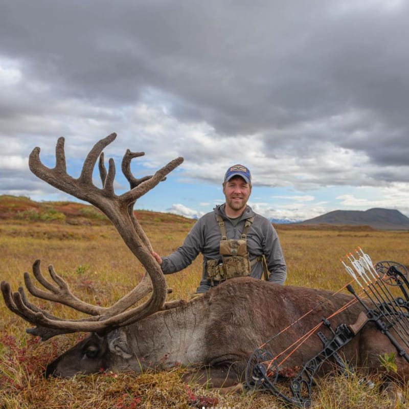
"I have interviewed most of the best big game hunters in the world. The one thing they all have in common is their ability to plan a hunt. Mark Livesay is hands down the best E-scouting guru I have ever met, and this course will absolutely help take your hunting to the next level."
Brian Barney
Eastmans Elevated Podcast
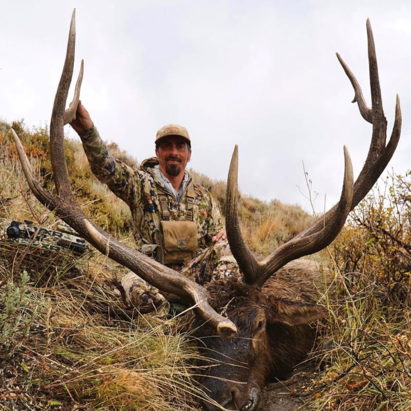
"Mark Livesay has developed the best comprehensive resource to build a successful hunt plan. He has broken down how to dissect a unit and find productive elk habitat. E-scouting is one of the most crucial skills to learning new spots and this program will take it to a higher level."

Derek Corey
"Taking your course really helped with efficiency, I hunted 6 days this year arrowed a bull at 10 feet the first day out, and only took me 5 more days to kill this 190-inch buck! Now my hunt plans are not random hunches. Your course is worth every penny!"

Does This Sound Familiar?
- I dream of chasing elk out west
- I have no idea where to start looking!
- I don't know how to researching the best unit
- I've been hunting elk for a few years with limited to no success!
- I have had success elk hunting, but I want to be more consistent!
I can assure you I've been in all of these camps! Over the past 30+ years I’ve honed and refined my elk-finding system. The E-Scouting Elk Course when paired with the Hunt IQ Suite takes your planning and execution to the next level. I personally guarantee it!
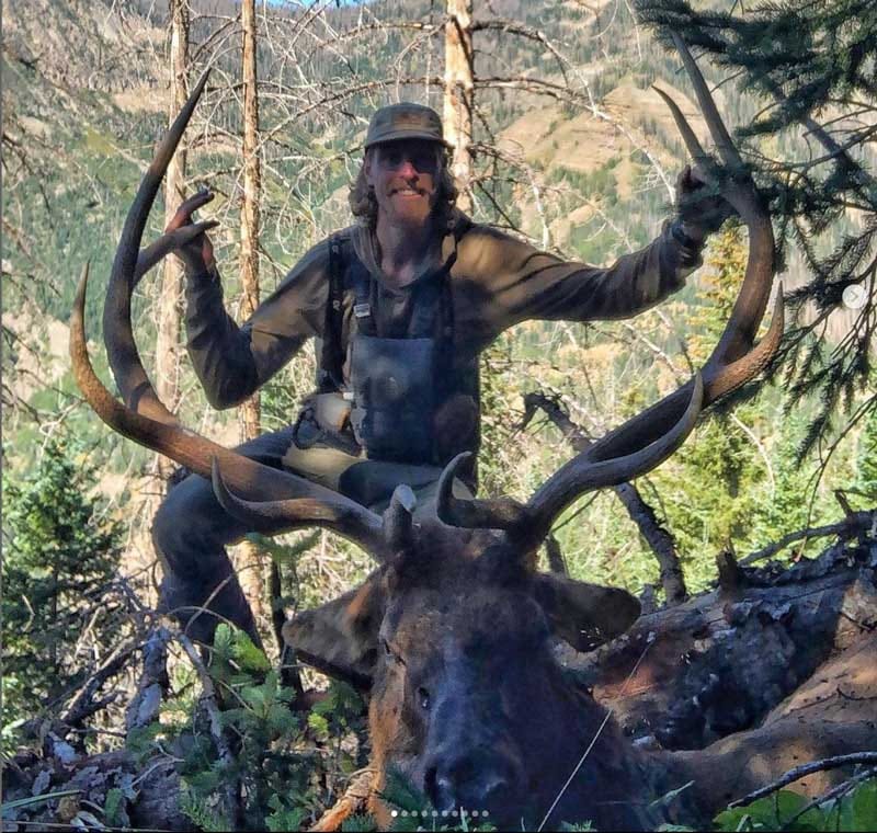
"Hey Mark! I got my first bull elk this year and wanted to thank you for the information you shared. I signed up for your course about 4 months ago and have also listened to just about every podcast you’ve been on. The info you have shared on E-Scouting and Hunt Planning was a real game changer for me and I would not have been as prepared as I was had it not been for those resources. Just wanted to say thanks for everything, hope your season is going well!"
Austin
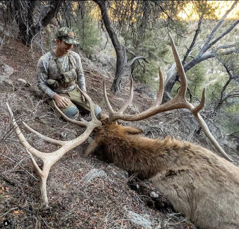
"Wanted to thank you for creating Treeline Academy. I live in Florida, but my passion is western hunting. I thought I was pretty good at E-Scouting but was humbled after taking your course. I found this bull on opening morning in my number one spot. It’s a bull of a lifetime and wanted to personally thank you for teaching me the theory and e-scouting techniques to make it happen."
N° of Nowhere

The Treeline Academy has been honored to be a guest on dozens of hunting’s very best podcasts!
CLICK for a listing of all podcast episodes in one location!

